Translate this page:
| Pincode | 676503 |
| Name | Chappanangadi B.O |
| District | Malappuram |
| State | Kerala |
| Status | Branch Office(Delivery) |
| Head Office | Tirur(kerala) H.O |
| Sub Office | Kottakkal S.O |
| Location | Tirur Taluk of Malappuram District |
| Telephone No | Not Available |
| SPCC | TIRUR-676101 |
| Department Info | Tirur Division Calicut Region Kerala Circle |
| Address | |
| Services | |
| Indian Postal Code System Consists of Six digits. The first to digits represent the state, the second two digits represent the district and the Third two digits represents the Post Office.In this case the first two digits 67 represents the state Kerala, the second two digits 65 represent the district Malappuram, and finally 03 represents the Post Office Chappanangadi B.O. Thus the Zip Code of Chappanangadi B.O, Malappuram, kerala is 676503 | |


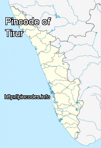
Tirur is a municipal town in Malappuram district in the Indian state of Kerala spread over an area of 16.55 square kilometres (6.39 sq mi). It is one of the business centers of Malappuram district and is situated 26 kilometres (16 mi) west of Malappuram and 41 kilometres (25 mi) south of Kozhikode, on the Shoranur–Mangalore section Section of the Mangalore–Chennai railway line. Tirur is also a major regional trading centre for fish and betel leaf and has an average elevation of 2 metres (6 ft 7 in). As of 2001 India census, Tirur had a population of 53,650, of which 48% are male and 52% female. Tirur has an average literacy rate of 80%, higher than the national average of 59.5%: male literacy is 81%, and female literacy is 78%. In Tirur, 14% of the population is under six years of age. Tirur assembly constituency is part of Ponnani (Lok Sabha constituency).
Tirur was part of the Kingdom of Tanur (Vettattnad) in medieval times and the sMore Info